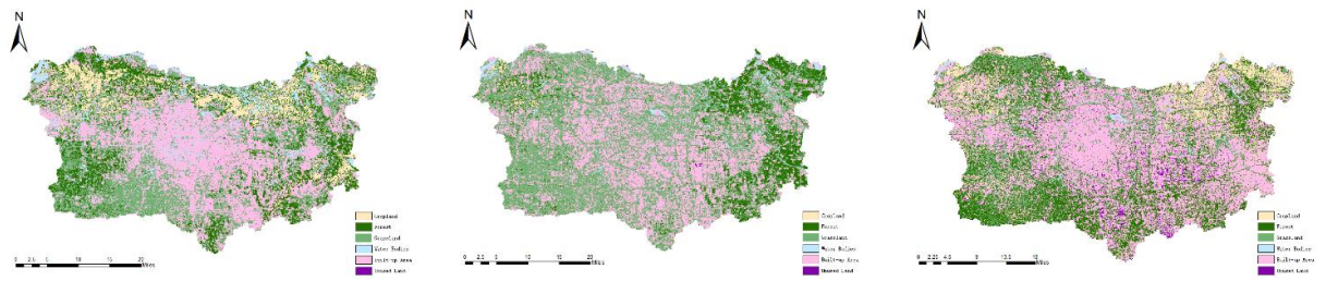
In the rapid process of urbanization, urban green spaces are critical for mitigating the urban heat island effect, enhancing carbon sink capacity, and improving overall environmental quality. This study employed multi-source high-resolution remote sensing data, fused with LiDAR observations and validated by field sampling, to accurately extract key parameters including green space types, coverage, and biomass. A systematic evaluation of ecological service functions and their dynamic changes was conducted. The results indicate that: (1) ecological functions differ significantly across green space types, with intensity closely linked to spatial configuration, highlighting the importance of balancing both “quality” and “quantity”; (2) the integration of remote sensing and LiDAR greatly improves the accuracy of ecological assessments; (3) dense construction and fragmented green patterns weaken ecological benefits, while higher vegetation diversity helps mitigate these negative impacts; (4) differentiated strategies tailored to functional areas can maximize ecological effectiveness. Overall, the study advances technical applications of remote sensing in urban ecology, deepens the scientific understanding of the “pattern–function” mechanism, and provides practical guidance for urban ecological planning and green space management under dual-carbon goals.